

GeoField

100+
Downloads

Everyone
info


About this app
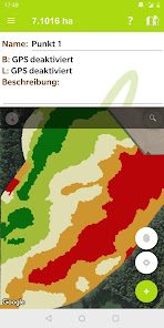
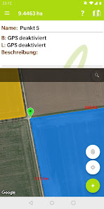
Capture the selected area and its size anywhere, in just a few seconds.
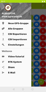
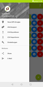
Convenient data management and long-term assurance of this, allow maximum convenience.
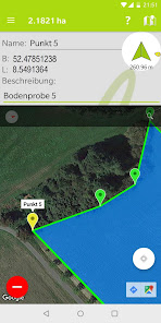
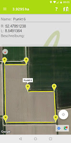
• Capture surfaces using GPS acquisition or Manuel on the display and calculate the size.
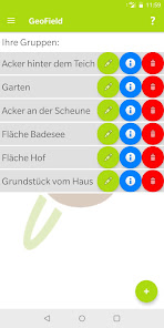
• Label each GPS point individually and save detailed descriptions
• Clear storage and management of measured data intuitively designed
• Display data in a CSV file clearly and have it exported for further use.
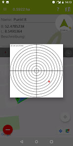
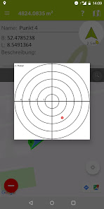
• Find points easily and precisely using the compass function
If you have any questions / problems with the APP or for downloading and would like to share your suggestions, please contact us.
Your AGRARPOHL team
Convenient data management and long-term assurance of this, allow maximum convenience.
• Capture surfaces using GPS acquisition or Manuel on the display and calculate the size.
• Label each GPS point individually and save detailed descriptions
• Clear storage and management of measured data intuitively designed
• Display data in a CSV file clearly and have it exported for further use.
• Find points easily and precisely using the compass function
If you have any questions / problems with the APP or for downloading and would like to share your suggestions, please contact us.
Your AGRARPOHL team
Updated on
Data safety
Developers can show information here about how their app collects and uses your data. Learn more about data safety

No information available
What's new
Added function for recording points at time intervals